")
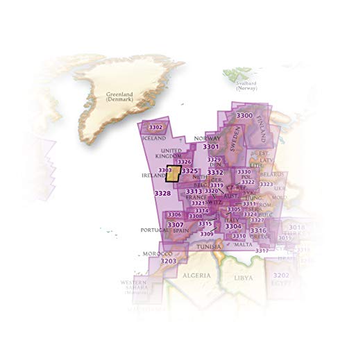
Ireland Map (National Geographic Adventure Map, 3303)
$14.95

Price: $14.95
(as of Nov 16, 2023 23:09:38 UTC – Details)
• Waterproof • Tear-Resistant • Travel Map
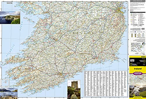
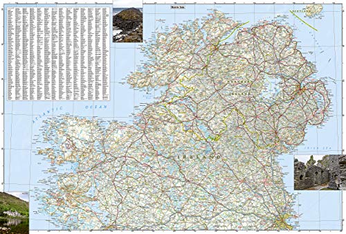
Explore the storied “Emerald Isle” with National Geographic’s Ireland Adventure Map. Designed to meet the needs of adventure travelers with its detailed, accurate information, this map includes the location of cities and towns with a user-friendly index and a clearly marked road network complete with distances and designations for roads/highways, plus secondary routes for those seeking to explore off the beaten path. Specialty content such as hundreds of diverse and unique recreational, ecological, cultural, and historical destinations make Adventure Maps the perfect companion to a guidebook.
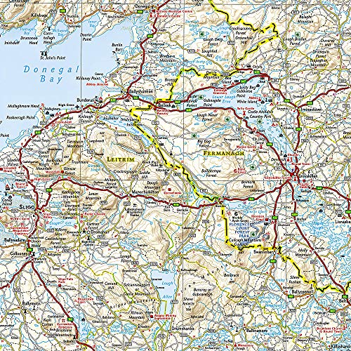
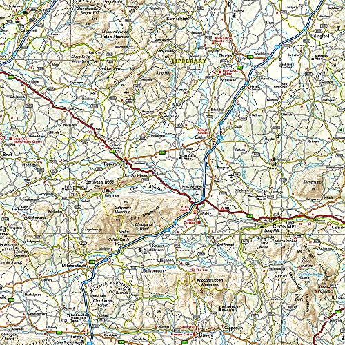
The Ireland Adventure Map covers the entire island including the Republic of Ireland and British-ruled Northern Ireland in one easy-to-use map. The north side of the map details from the northernmost tip of the island at Malin Head south to Dublin and Galway, including Belfast, Dundalk, Londonderry, and Sligo. The south side overlaps the northern side of the map at Galway on the west and Dublin on east, covering the remainder of the country including the cities of Limerick, Tralee, Cork, and Waterford.
Ireland’s lush green landscape is a result of its temperate, oceanic climate. The island’s geography is mostly comprised of a central plain surrounded by relatively low-lying mountains. Coastal regions vary from sandy beaches to towering cliffs that rise hundreds of feet above the pounding surf. Castles, churches, abbeys, monasteries, and Neolithic sites abound, offering travelers a remarkable variety of opportunities to explore Ireland’s rich and ancient cultural history.
Every Adventure Map is printed on durable synthetic paper, making them waterproof, tear-resistant and tough — capable of withstanding the rigors of international travel.
Map Scale = 1:385,000Sheet Size = 37.75″ x 25.5″Folded Size = 4.25″ x 9.25″
From the Publisher


National Geographic’s Adventure Maps — Essential travel tools for destinations across the globe
With over 100 available titles, these detailed travel maps are the perfect companion for the trip of a lifetime. Sometimes an accurate, tough, waterproof map is the best travel tool you can carry. In areas without cell coverage, or when the data plan is running low, a National Geographic Adventure Map will quickly become an essential travel tool. Featuring detailed road networks, key points of interest, UNESCO World Heritage sites, a place name index, and beautifully rendered shaded relief these travel maps are perfect for pre-trip planning and on the ground navigation.
Perfect for Domestic or International Travel Waterproof Tear-Resistant Nearly Indestructible Clean Cartographic Design for Easy Navigation
Number of International Visitors
1.3 million 3.0 million 32.6 million 2.6 million 3.4 million
Official Language
Icelandic English and Māori Thai Spanish Spanish
Unit of Currency
Icelandic Króna New Zealand Dollar Thai Baht Costa Rican Colón Sol


Your Purchase Has Purpose
Every purchase helps support the National Geographic Society, an impact driven, nonprofit organization with global reach that uses the power of science, exploration, education, and storytelling to illuminate and protect the wonder of our world.
Publisher : Natl Geographic Society Maps; 2019th edition (January 1, 2019)
Language : English
Map : 2 pages
ISBN-10 : 1566955351
ISBN-13 : 978-1566955355
Item Weight : 3.35 ounces
Dimensions : 9.25 x 0.16 x 4.25 inches


There are no reviews yet.