
Rand McNally Easy to Fold: New England Laminated Map
$9.99


Price: $9.99
(as of Jan 29, 2024 06:34:23 UTC – Details)
The durable convenient Rand McNally Easy To Fold maps will take all the wear and tear your journey can dish out. The New England Easy To Fold features clearly indicated highways, county boundaries, streets, points of interest, national parks, and more, with a quick-reference legend and a city index. – Laminated design allows you to mark your route, make notes, then wipe the surface clean for further use. – Map easily folds to display individual sections and eliminates the headache of refolding a paper map in the car. – Highways, county boundaries, streets, points of interest, national parks, and more shown on map. Product Details: Measures 9 x 4.25 folded; 18 x 17 unfolded.
From the Publisher


Folded Laminated Maps
Offering unbeatable accuracy and reliability, Rand McNally folded maps have been the trusted standard for years.
The easy-to-use legend and detailed index make for quick and easy location of destinations.
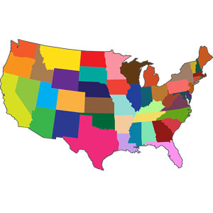
Available in All 50 States
Whether it’s your home state or just passing through, Easy to Fold! maps help you navigate the adventures ahead.
Rand McNally Easy to Fold State Maps


Durable and tear resistant
The Rand McNally Easy To Fold state map stands up to traveling wear and tear. A must-have for navigation whether you’re a state resident or just passing through.
Write on, wipe off
Featuring heavy-duty lamination, The map’s smooth surface allows for marking your route, making notes, then wiping it clean for future use.
Easy to fold
The map folds to display individual map sections. Plus, folds easily when finished — no more fumbling.
Colorful, user-friendly info
The full-color map features enhanced cartography, a quick-reference legend and city index, and clearly indicated highways, county boundaries, points of interest, and more.
Folded
✓
✓
Heavy Duty Lamination
✓
Points of Interest
✓
✓
Limited Access Highways (Free and Toll)
✓
✓
Principal Highways
✓
✓
Highway Mileages
✓
✓
State or Provincial Capitals
✓
✓
Map Scale
✓
✓
National Park Symbols
✓
✓
Large Print; Distances & Driving Times Map; Parks (Campsites; No Campsites); State Mileage Chart
✓
Publisher : Rand McNally (May 6, 2022)
Language : English
Map : 1 pages
ISBN-10 : 0528026151
ISBN-13 : 978-0528026157
Item Weight : 5.6 ounces
Dimensions : 4.1 x 0.6 x 8.8 inches


There are no reviews yet.