")
Mount Rainier National Park Map (National Geographic Trails Illustrated Map, 217)
$12.60


Price: $12.60
(as of Feb 27, 2024 17:35:26 UTC – Details)
• Waterproof • Tear-Resistant • Topographic Map
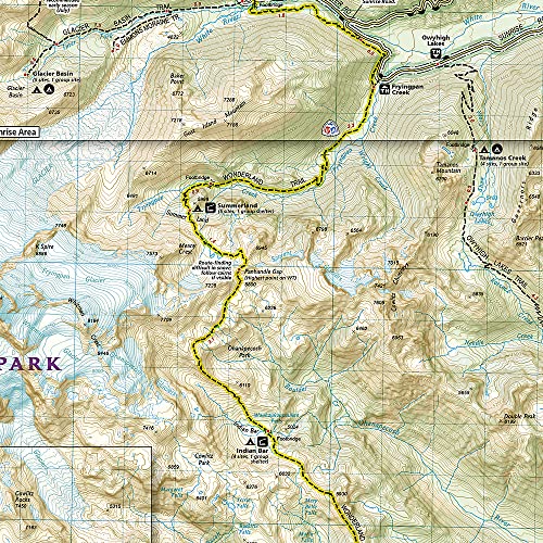
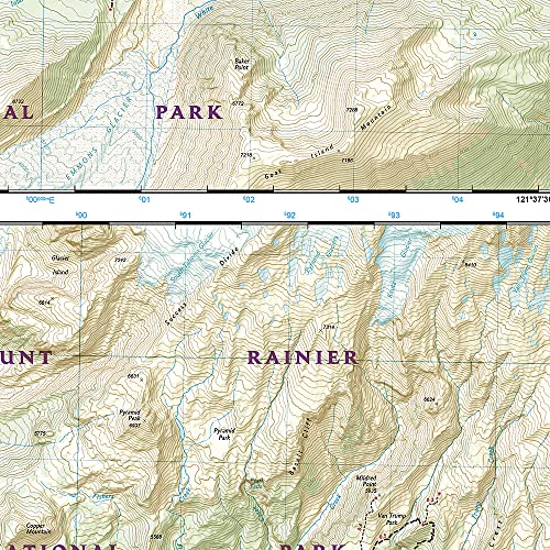
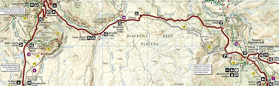
The highest point in the Cascade Range, Mount Rainier is an icon of Washington state. It is an active volcano and the largest single-peak glacial system in the lower forty-eight states, spawning 6 major rivers. National Geographic’s Trails Illustrated map of Mount Ranier National Park is designed to meet the needs of outdoor enthusiasts by combining valuable information with unmatched detail of this spectacular landscape of glaciers, old-growth forests, subalpine meadows, and valleys. Created in partnership with local land management agencies, this expertly researched map features key areas of interest including Paradise, Longmire, White River, Mowich Lake, Ohanapecosh, Chinook Scenic Byway, Crystal Mountain, and Glacier View Wilderness.
With extensive detail of Mount Ranier and its glaciers, and miles of clearly marked trails including the Pacific Crest and Wonderland trails, this map will prove invaluable in your exploration of the park. Mileages between intersections are shown and the map base includes contour lines and elevations for summits, passes and many lakes. Recreation features noted include ski areas, campgrounds, trailheads, lodging, horse camps, scenic overlooks, and more.
Every Trails Illustrated map is printed on “Backcountry Tough” waterproof, tear-resistant paper. A full UTM grid is printed on the map to aid with GPS navigation.
Other features found on this map include: Cascade Range, Chinook Pass, Comet Falls, Fairy Falls, Gifford Pinchot National Forest, Mount Rainier, Mount Rainier National Park, Norse Peak Wilderness, Sluiskin Falls, Snoqualmie National Forest, Tatoosh Range, Tatoosh Wilderness, William O. Douglas Wilderness.
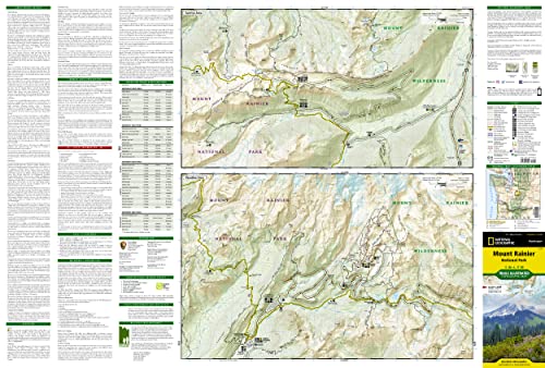
Map Scale = 1:55,000Sheet Size = 37.75″ x 25.5″Folded Size = 4.25″ x 9.25″
From the Publisher
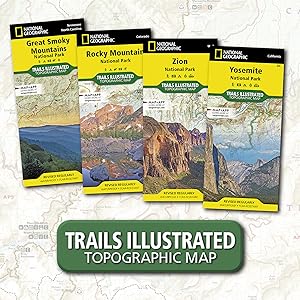
National Geographic Trail Maps – An essential tool for exploring America’s top National Parks
National Geographic’s line of Trails Illustrated maps includes detailed topographic trail maps for all of America’s top National Parks. Featuring updated and easy-to-read trail networks, important points of interest, and the key recreation information needed to make your next National Park visit an adventure.
National Geographic and the National Parks share a deep legacy dating back to the publication of an entire issue of National Geographic Magazine in 1916 titled ‘Land of the Best’. That issue helped advocate for the creation of the National Park Service, later that year. Over the years, National Geographic has helped establish, preserve, or restore Sequoia, Katmai, Carlsbad Caverns, Shenandoah, Mesa Verde and Redwood National Parks. It has also publicized the parks through at least 500 books, articles, and maps, not to mention dozens of television documentaries.
Backcountry Tough Waterproof Tear-Resistant Nearly Indestructible Detailed Topography GPS Compatible With full UTM Grid
Yearly Visitors
11.3 million 4.5 million 4.4 million 4.3 million 4.1 million
Date Established
1934 1919 1915 1890 1872
Miles of Trails
820 miles 88 miles 431 miles 782 miles 1,021 miles
State
North Carolina, Tennessee Utah Colorado California Wyoming, Montana, Idaho

Publisher : Natl Geographic Society Maps; 2022nd edition (January 1, 2022)
Language : English
Map : 2 pages
ISBN-10 : 1566953456
ISBN-13 : 978-1566953450
Item Weight : 3.25 ounces
Dimensions : 4.1 x 0.3 x 9 inches
User Reviews
Be the first to review “Mount Rainier National Park Map (National Geographic Trails Illustrated Map, 217)”
Related Products


![Canada [Map Pack Bundle] (National Geographic Adventure Map)](https://m.media-amazon.com/images/I/91VefdLzJWL._AC_SL1500_.jpg)
$12.60
There are no reviews yet.